This route runs along the marked path PR CV 355, which passes through numerous key points and links the Port of Xàbia with the top of Montgó.
If you are willing or willing to do one of the longest and most complete tours, of approximately 8 hours, with variable difficulty and with changing and very beautiful landscapes, here you have all the information.
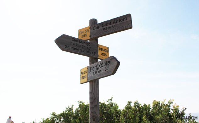 Signage located near Cabo de San Antonio, indicating the port, the top of Montgó and the cape itself
Next you have an index with all the points that we are going to deal with.
- 1.
- 2.
- 3.
Plan and layout of the route
La rue begins in the Levante dike, next to the Club Nautico de Javea. We ascend a path that leads to the Cala Tangó.

We continue to the left until the Viewpoint of Cap de Sant Antoni (Cape San Antonio) and we walk along the road in the opposite direction to the lighthouse, entering a pine forest that we find on the left.
We continue the route crossing to the other side of the road looking for the indication of Natural Park Montgó, until you reach a recreational area. Once there we walk along a forest track. We will pass by a police barracks in ruins, and further on, we will find the Sanctuary of the Mare de Déu dels Àngels. If we want, here we can divert to the Molinos de la Plana (old windmills). If not, we will continue straight towards the Montgó.

We continue along the road until we take the path to the Flat Sant Jeroni. After about 600 meters we leave the main road to take a path on the right. After 100 meters, at the crossroads, we will take the path to the right. The descent to the ravine begins there, we will help ourselves with a chain. Be careful, there are many loose stones. We will arrive in front of the sea, where the access to a cave is indicated on the left.
We continue half a kilometer along the path that runs along the coast until we reach the Barranc de l'Aiguadolça. We continue straight, and we will find two flights of steps. We walk along a dirt path and, at the fork, we turn left, reaching the Torre del Gerro.
We take a path heading south, skirting the ravine until we reach a house in ruins where the path ends. We connect with a path that leads to the highway Cap de Sant Antoni. We turn right and walk along the road for 250 meters. We cross the Dénia-Xàbia road and we enter a path in a pine forest. We come to a firebreak, we turn right and 200 meters further on we enter a pine forest on the left. After crossing the pine forest, we take another firebreak on the left.
We come to a crossroads where we find an information panel for the route. We continue straight, we cross a chain and at the fork we turn right. The road becomes a path, which connects with the PR 152 of Dénia. This is where the ascent to Montgó begins: we arrive first at the Red Penya and after a zig zag climb, to Montgó balcony, a good place to enjoy the views.
We continue climbing and the most difficult section begins: the rocky ridge. The path has ended and we walk between rocks. We arrive at top of Montgó. We go down the same ascent path, reaching the start panel at the Flat Sant Jeroni.
Technical data
The distance of this route until reaching the top of Montgó is 16 kilometers, 20 kilometers including the descent. The duration approximate time is 7 hours 45 minutes and difficulty it is considered to be high.
Next, a graph shows the profile of the trail, and you can see how the altitude rises or falls as we advance in distance and time.

Images
-
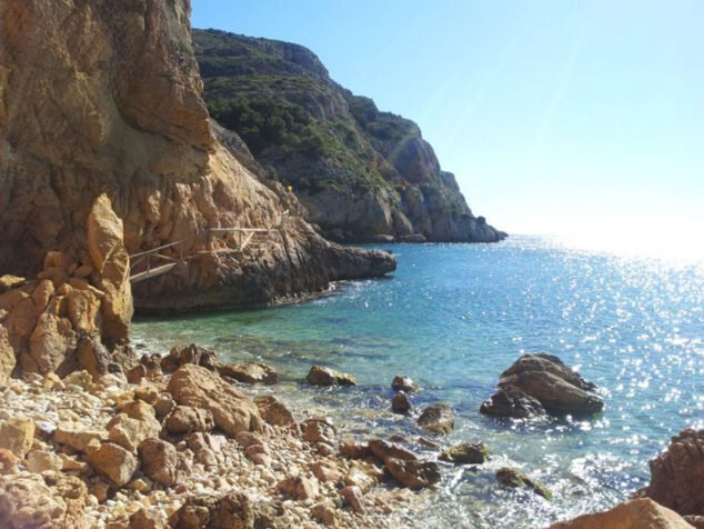
 View of Cala Tangó in Xàbia
-
Image of Molins de Xàbia

-
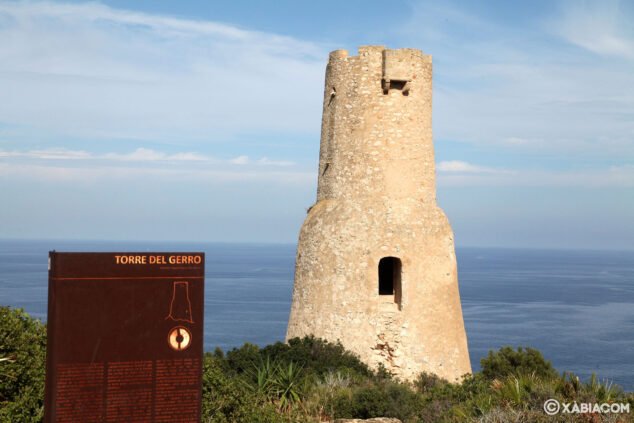
 The Torre del Gerro with the sea in the background
-
View of the bay of Xàbia from the top of Montgó


