Enjoy nature in the surroundings of the Montgó entering the Natural Park through various marked routes. In the following article, you have the itineraries ordered by difficulty, so you can choose which one you want to follow, along with a short description and its duration. Some routes touch other municipalities, such as Dénia and Jesús Pobre.
Next you have an index with all the points that we are going to deal with.
- 1.
- 1.1.
- 1.2.1.
- 1.2.2.
- 1.2.3.
- 1.2.
- 1.3.1.
- 1.3.2.
- 1.3.3.
- 2.
Hiking routes
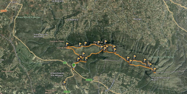
Here you have a map of the routes that are carried out through the Natural Park. Click on the image to enlarge it.
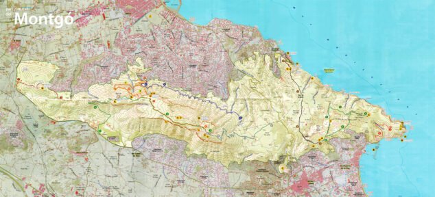
Below are the main itineraries the Montgo that are carried out from Xàbia, according to their difficulty.
Easy
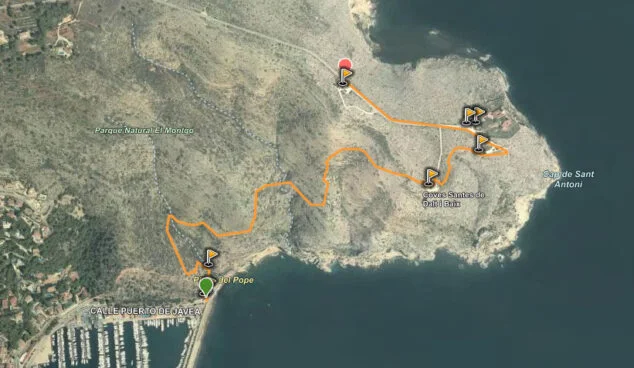
Cape of San Antonio-Port de Xàbia
- Estimated duration: 35 minutes
Marked on the plan with the number 9. This route begins at the first viewpoint next to the road to the Cape San Antonio, before the lighthouse. From here there are beautiful views of the cliffs, the bay of Xàbia, the mountains of the granadella, from Puig de la Llorença and in the background, the Peñón de Ifach. A path will lead us down to the pope's cove o cove tango, next to the port. We provide you with a more detailed description of the route.
Tower of Gerro-Molins
- Estimated duration: 55 minutes
Marked on the plan with the number 7. This route begins in Dénia and ends in Xàbia. It starts at Torre del Gerro: to get there you have to park at the end of Les Rotes and go up Vía Láctea street, which is quite steep. Once in the tower, you have to follow the signs that indicate the direction towards the mills. If you want to know more, see the in-depth article on the Torre del Gerro-Molins route.
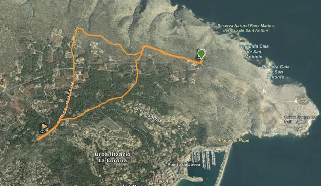
Recreational area-Molins
- Estimated duration: 55 minutes
Marked on the plan with the number 8. This route begins in the recreational area that is 700 meters before reaching the Cape San Antonio lighthouse. The beginning of the path enters a pine forest, and shortly after we will arrive at an old barracks in ruins. We will continue to the left to reach the Sanctuary of the Mare de Deu dels Àngels. Following the path lined with cypresses, we arrive at the mills, a group of unique windmills in the Valencia. find here More information about this itinerary.
of high difficulty
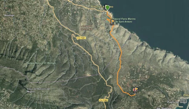
Dénia-Cima shooting range
- Estimated duration: 1 hour 45 minutes
Marked on the plan with the number 6. This route starts at the Dénia shooting range, next to the CV-736 road (the road to Les Planes). The beginning is signposted next to the car parks. We continue along the path, we come to a wide track and shortly after the zig zag ascent begins. In the last kilometer to the top we will cross a rocky ridge, so the difficulty is considerable. For more information, read the Background article on the route from the Shooting Range to the top.

Jesus Pobre-Cima
- Estimated duration: 3 hours 45 minutes
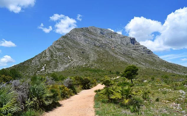
Marked on the plan with the number 2. This route begins on the Mitjans road, in Jesús Pobre, a town located within the Dénia district, but constituted as a Minor Local Entity since 1999. We take a cobbled path that passes next to a fire-fighting water tank, which in 500 meters it becomes a path. Following this path, we find the remains of the Iberian wall of the town of La Penya de l'Águila, 5nd century BC. Following this itinerary, we are covering the entire Montgó hill, and we are going to come across route 753 (the other route that goes to the top, from Camí de la Colònia) and the detour that goes up to La Creueta. But always following the main path we will reach the top of Montgó, the point that rises XNUMX meters above sea level. Meet here more details of this itinerary.
The most complete and longest itinerary: Port de Xàbia-Cima
- Estimated duration: 7 hours 45 minutes
This is the longest route and includes various points that are already contained in previous routes. It begins at the Levante dam, next to the Club Nautico de Javea. And it leads to Cala Tangó, the Mirador del Cap de Sant Antoni, the mills, the ravine of l'Aiguadolç, the Cova Tallada, the Torre del Gerro and finally, the top of Montgó. The path that makes this route is the PR CV 355, here is a map of the entire route.
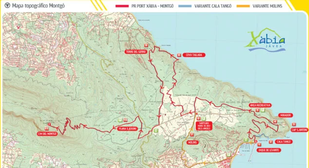
Enter the in-depth information on the Port of Jávea-Montgo route.
Recommendations and things you should know
Before setting out on the road, you have to be informed of these aspects:
- It is very important to always follow the marked path or path, without leaving
- Remember that the collection of plants, animals or stones is not allowed
- You must respect the tranquility of the environment, and avoid making strange sounds that may disturb the animals
- Of course, it is not allowed to make fire, and neither is camping
- The mountain bike can be used on the network of roads and paths, but not on trails or cross country
- And always, pick up your trash to keep the mountain clean

hello, can you please tell me who makes trips to the top of montgo please, carl
Hello Carl, your words are of interest. Wir Feind Anfang März dort und würden uns gern einem Wanderführer anschließen, wenn so etwas möglich ist. Beste Grüße aus Seligenstadt, Regina
To the hikers, please remember to take your garbage in your backpacks, then they will deposit it in garbage cans.
DO NOT THROW GARBAGE ON THE ROADS.
DO NOT LEAVE GARBAGE BAGS ON THE ROADS.
Thank you.