El Natural Park Montgó contemplate different hiking routes. This route that we present in this article, the one chosen by the majority of hikers and tourists, begins at the Dénia firing range, next to the CV-736 road (the Les Planes). It is a shorter journey than the route from Jesús Pobre to the top, also widely used. However, this itinerary that we explain now has much more pending, so you must assess which one you prefer to do.
Next you have an index with all the points that we are going to deal with.
- 1.
- 2.
Technical data
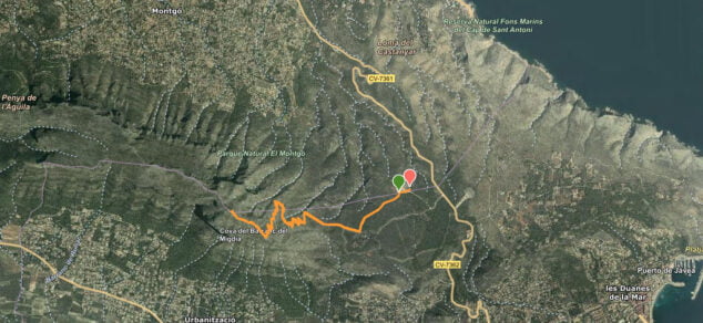
La distance that we will travel on this route is almost 4 kilometers, specifically, 3874 meters. The duration Estimated time is 1 hour 45 minutes and difficulty considered of this route is high.
Route layout
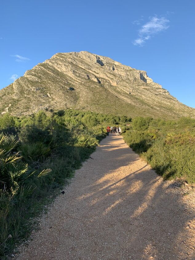
As indicated by Wikiloc, the exit of this route It starts from the Dénia shooting range, which we reach by a dirt track from the CV-736. The beginning is signposted next to the car parks. We continue along the path that reaches a wide track, and we continue to the right towards Montgó.
The gravel track leads to a stony path that zigzags upwards. In the last section, the ascent is more difficult because we will go up the limestone ridge before reaching the top. There are many slopes and areas where you will need to use your hands to support yourself and move forward.
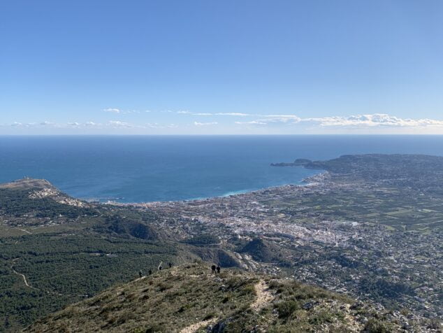
In addition to the beautiful views from the top of Montgó, where you can see the bay of Xàbia and part of the port of Dénia. You can also, with a bit of luck, enjoy the flight of the Bonelli's Eagle or the Peregrine Falcon.
Once at the top it is very easy for you to also find the base of what was the Creu del Montgo o Creu de Xàbia, which unfortunately no longer exists today due to vandalism.
-
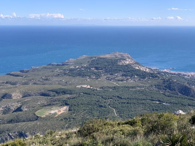
 View of Cabo San Antonio from the top of Montgó
-
View of the bay of Xàbia from the top of Montgó